
VP03 - Castilblanco de los Arroyos - Almadén de la Plata - 29,5 km
Distance30 Km.Related packages
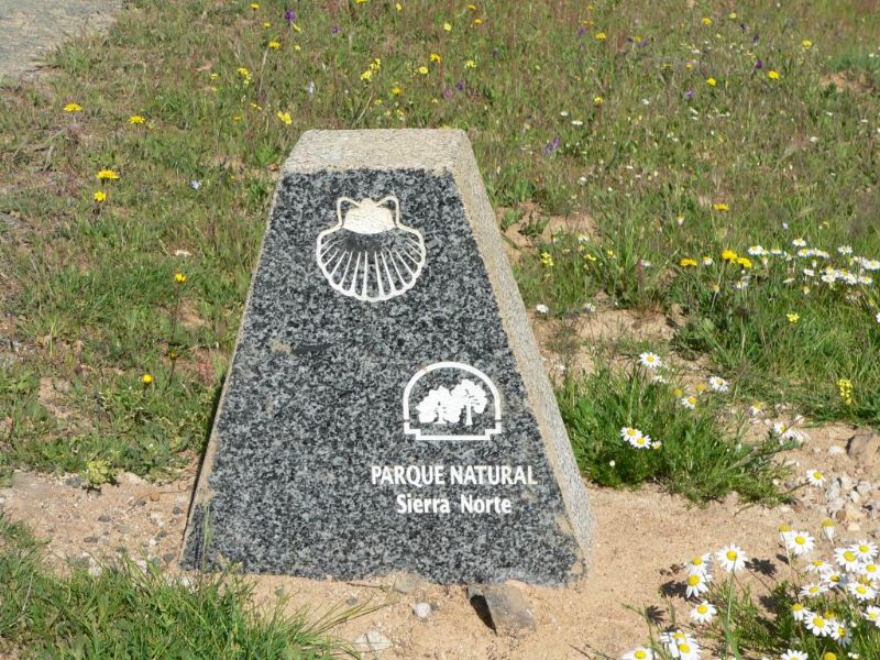
Stage of the Camino de Santiago: Guillena to Castilblanco de los Arroyos
The stage of the Camino de Santiago from Guillena to Castilblanco de los Arroyos is one of the most representative of the Seville route, offering a unique experience in the heart of Andalusia. Throughout this stage, pilgrims enjoy a route that combines natural beauty and a peaceful rural atmosphere.
Route Description: Guillena to Castilblanco de los Arroyos
The route begins in the town of Guillena, located about 23 km from Seville, and continues towards Castilblanco de los Arroyos. In this stage, pilgrims cover an approximate distance of 19 km, passing through rural paths, dirt roads, and trails surrounded by olive fields and typical vegetation of the region. Along the way, rural landscapes, forests, and some streams can be observed.
Route Features: Easy and Pleasant Path
This stretch of the Camino de Santiago is relatively easy and suitable for pilgrims of all levels. Although it features some gentle elevation changes, it is not considered a particularly difficult stage. The dirt paths and short asphalted sections allow for comfortable progress, making this stage ideal for those who wish to enjoy the landscape without facing significant challenges.
Points of Interest on the Camino
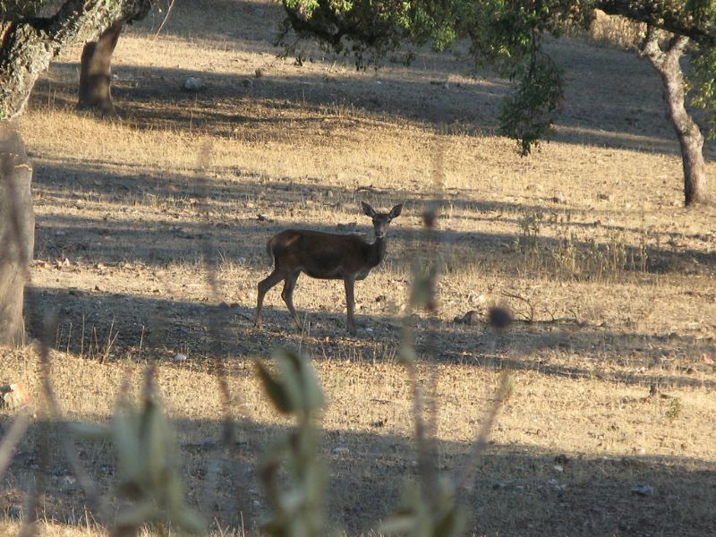
Along the route, pilgrims can enjoy several points of interest, such as the small village of Castilblanco de los Arroyos, famous for its typical Andalusian architecture and beautiful landscapes. Pilgrims also pass near the "El Almendral" estate, a place known for its natural beauty and peaceful atmosphere. Along the way, there are several hostels and resting areas, making this stage comfortable for walkers.
Arrival at Castilblanco de los Arroyos: End of the Stage
The stage ends in Castilblanco de los Arroyos, where pilgrims can enjoy the calm of this small village. In this town, all types of services are available, such as hostels, restaurants, and shops to replenish energy before continuing the journey. From here, pilgrims prepare to continue the route to the next stage of the Camino de Santiago.
Tips for Pilgrims
It is important to carry enough water, especially in the warmer months, as the Andalusian sun can be very intense. It is also recommended to carry a good map of the Camino de Santiago to follow the route safely.
Starting from the town hall square of Guillena, the route heads out through the sports center and turns right to cross the Rivera de Huelva river.
The yellow arrows guide us to a nearby inn, where we turn left to immediately cross the Guillena-Burguillos road and continue with a gentle ascent to Castilblanco de los Arroyos.
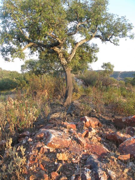
From this point onwards, the route is dominated by livestock estates with cork oak and holm oak land. The signs guide us to the end of the stage. Before reaching the town, we pass by the Castillo Blanco hotel located next to the road leading to the town.
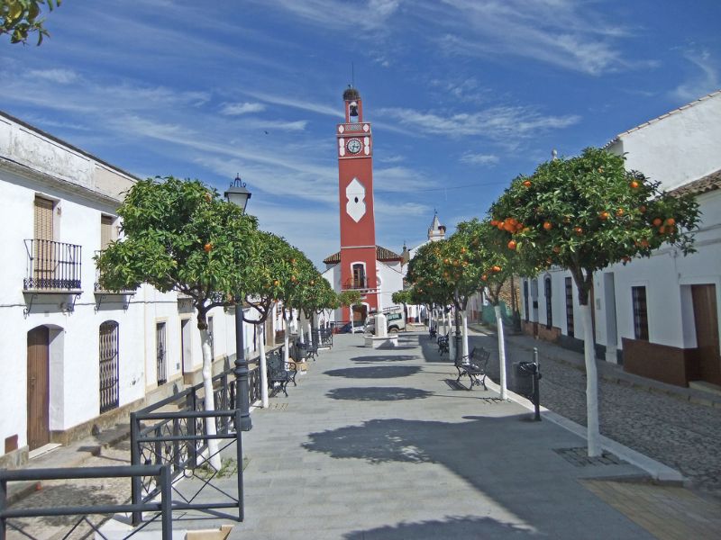
CASTILBLANCO DE LOS ARROYOS
Altitude: 328 m.
Distance to Almadén de la Plata: 29.5 km.
The historical data from the Roman era is important, as some interesting remains have been found. The natural route of the area was suitable for communication along the Roman road that passed through here according to the Antonine Itinerary, which was adapted in the mid-2nd century AD by Emperor Hadrian. This route is also well documented from the medieval era, following the course of the Viar river.
What to see: Ermita de Ntra. Sra. de Escardiel, Church of the Divine Savior, and Ermita de San Benito.
External information sources for this route and recommended websites:
Association of Friends of the Camino de Santiago of Seville
Tourism Castilla y León
Stages
- VP01 Sevilla - Guillena , 22 km
- VP02 - Guillena - Castilblanco de los Arroyos - 19 km
- VP03 - Castilblanco de los Arroyos - Almadén de la Plata - 29,5 km
- VP04 - Almadén de la Plata-Monesterio - 34,5 km
- VP05 - Monesterio-Fuente de Cantos - 21,6 km
- VP06 - Fuente de Cantos - Zafra - 24,6 km
- VP07 - Zafra - Almendralejo - 36,7 km
- VP08 - Almendralejo - Mérida - 29,6 km
- VP09 - Mérida - Alcuéscar - 36 km
- VP10 - Alcuéscar - Valdesalor - 25,7 km
- VP11 - Valdesalor - Casar de Cáceres - 22,8 km
- VP12 - Casar de Cáceres - Cañaveral - 33,2 km
- VP13 - Cañaveral - Galisteo - 28 km
- VP14 - Galisteo - Cáparra - 29,5 km
- VP15 - Cáparra - Baños de Montemayor - 28,5 km
- VP16 - Baños de Montemayor - Fuenterroble de Salvatierra - 32,9 km
- VP17 - Fuenterroble de Salvatierra - San Pedro de Rozados - 28 km
- VP18 - San Pedro de Rozados - Salamanca - 23,4 km
- VP19 - Salamanca- El Cubo de la Tierra del Vino - 35 km
- VP20 - El Cubo de la Tierra del Vino - Zamora - 31,6 km
- VP21 - Zamora - Montamarta - 18,5 km
- VP22 - Montamarta - Granja de Moreruela - 22,7 km
- VP23 - Granja de Moreruela - Benavente - 25,5 km
- VP24 - Benavente - Alija del Infantado - 22,1 km
- VP25 - Alija del Infantado - La Bañeza - 20,5 km
- VP26 - La Bañeza - Astorga - 24,2 km