
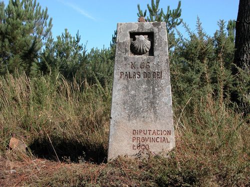
CF32 - Portomarín - Palas del Rei - 23,9 km
Distance24 Km.Related packages

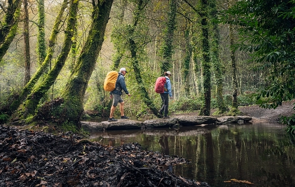
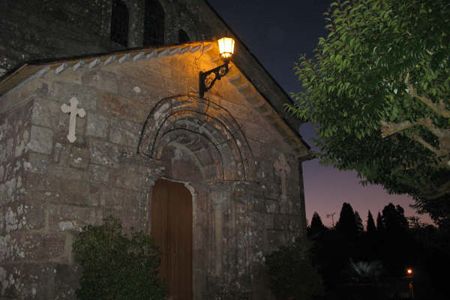
Start of the Stage: Descent from the Refuge
From the Portomarín refuge, descend the steep and arcaded main street until reaching the C-135 road. After a few metres, leave the road to the left and cross a branch of the Belesar Reservoir via a narrow footbridge. From here, the path skirts the San Antonio Mountain, with the Torres river on the right, ascending gently.
The Way to San Mamed
After approximately 2 km, the route returns to the C-135 at the junction to San Mamed. On the right, the small hamlet of Cortapezas can be seen, while on the left is a traditional pottery. Continuing along the road, Toxibo is reached in 2 km, and Gonzar in another 3 km.
Detour to Castromaior
Upon leaving Gonzar, the road is abandoned to the left, and a dirt path leads to the small settlement of Castromaior. The landscape along the path is dotted with small oaks, pines, and broom, with gently rolling terrain.
Continuation Along the Road and the Hospital de la Cruz
Shortly after, the path returns to the road, following it for 1 km with a gentle ascent. Then, a path to the left leads to the Hospital de la Cruz. Here, the N-540 is crossed, and the route continues along a paved track that, after about 10 km, joins the N-547 at the settlement of Brea.
10 km Route: Ascents and Descents
This 10 km section passes through several key points:
- At 1.5 km, Ventas de Narón is reached.
- Next, the Sierra de Ligonde is ascended gently, before descending to Prebisa, Lameiros, and finally Ligonde.
- The Ligonde river is crossed, followed by an ascent to Eirexe, continuing the climb until reaching the road to Monterroso.
- From here, the descent begins towards Portos.
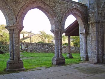
Detour to the Temple of Vilar de Donas
Just after leaving Portos, a detour to the right leads to the famous Romanesque temple of Vilar de Donas, located about 3 km away, on the other side of the N-547.
Route to Palas de Rei
After passing through Lestedo, the cemetery and the Church of Santiago are left on the left, and a short ascent brings you into Valos. After 1 km, the small place of Mamurria is reached, and the track emerges onto the N-547 at the height of Brea.
Arrival at Palas de Rei
From Brea, continue along a path parallel to the road for 3 km towards Palas de Rei. On the left, before entering the town, the municipal sports facilities are found.
Stages
- CF01 - Saint Jean de Pied de Port - Roncesvalles - 21 km
- CF02 - Roncesvalles - Zubiri - 22 km
- CF03 - Zubiri - Pamplona - 20 km
- CF04 - Pamplona - Puente la Reina - 19 km
- CF05 - Puente la Reina - Estella - 19,7 km
- CF06 - Estella - Los Arcos - 20,6 km
- CF07 - Los Arcos - Viana - 18 km
- CF08 - Viana - Navarrete - 22,3 km
- CF09 - Navarrete - Nájera - 16,9 km
- CF10 - Nájera - Santo Domingo de la Calzada - 21 km
- CF11 - Santo Domingo de la Calzada - Belorado - 22,7 km
- CF12 - Belorado - San Juan de Ortega - 24 km
- CF13 - San Juan de Ortega - Burgos - 27,6 km
- CF14 - Burgos - Hornillos del Camino - 18,3 km
- CF15 - Hornillos del Camino - Castrojeriz - 20,40 km
- CF16 - Castrojeriz - Frómista - 24,90 km
- CF17 - Frómista - Carrión de los Condes - 19,2 km
- CF18 - Carrión de los Condes - Lédigos - 23,40 km
- CF19 - Lédigos - Sahagún - 17,10 km
- CF20 - Sahagún - El Burgo Ranero - 17,9 km
- CF21 - El Burgo Ranero - Mansilla de las Mulas - 18,7 km
- CF22 - Mansilla de las Mulas - León - 18,4 km
- CF23 - León - Villadangos del Páramo - 21,8 km
- CF24 - Villadangos del Páramo - Astorga - 26 km
- CF25 - Astorga - Rabanal del Camino - 20,6 km
- CF26 - Rabanal del Camino - Molinaseca - 24,7 km
- CF27 - Molinaseca - Villafranca del Bierzo - 30,5 km
- CF28 - Villafranca del Bierzo - O Cebreiro - 30 km
- CF29 - O Cebreiro - Triacastela - 22,9 km
- CF30 - Triacastela - Sarria - 22 km
- CF31 - Sarria - Portomarín - 22 km
- CF32 - Portomarín - Palas del Rei - 23,9 km
- CF33 - Palas del Rei - Arzúa - 28,6 km
- CF34 - Arzúa - Santiago de Compostela - 38,4 km
- CF35 - O Pedrouzo - Santiago de Compostela - 20 km