
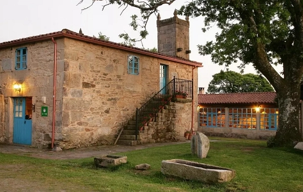
CF24 - Villadangos del Páramo - Astorga - 26 km
Distance26 Km.Related packages

Stage of the Camino de Santiago: From Villadangos to Astorga
This stage of the Camino de Santiago offers a varied route, ranging from natural surroundings to the historic city of Astorga, with unique landscapes and iconic places along the way to Compostela.
Departure from Villadangos: The Camino between Poplars and Crops
At the end of the crossing of Villadangos, the path takes us through a magnificent poplar grove. After crossing a stream, we continue along a path parallel to the N-120 for about 4.5 kilometres until we reach San Martín del Camino. Upon leaving the town, the route continues near the road, surrounded by irrigated fields that have transformed what was once an arid plain.
Crossing the Canals and Arrival at Puentes de Órbigo
At 6.5 kilometres from the start, we cross one of the many irrigation canals of this stage. At that point, we turn right towards Puentes de Órbigo. Here, we cross the impressive Paso Honroso Bridge and enter Hospital de Órbigo via its Calle Mayor, passing by the remains of the old Hospital and the church of San Juan. At the end of this street, there is a fork towards the N-120 and Villares de Órbigo, about 2 kilometres away.
Ascent to Monte de la Colomba
From Hospital de Órbigo, we take an asphalted track until we reach Santibáñez de Valdeiglesias, about 2.5 kilometres away. From there, the path continues along a dirt track that ascends to Monte de la Colomba, surrounded by holm oaks. After ascending, we reach a ravine on the left. Here, the path forks and we must take the left trail, which leads us to a barren valley.
Forks and Final Ascent
When we reach a new fork, we take the path to the right, a cobbled trail surrounded by oaks and shrubs. This leads us to a wide dirt track, which we leave to the right to follow a mountain path that ascends through the vegetation. From the top, we descend into a small valley, cross the Arroyo Grillo, and ascend to a plateau while heading towards Teleno and Astorga, which are visible in the distance.
Arrival at San Justo de la Vega
To the right of the path, there is an extensive pasture with a sheepfold. At a new crossroads, we take the central branch until we reach the Crucero de Santo Toribio, from where we descend along the Camino de la Cañada to San Justo de la Vega. If we had taken the path to the right, which is straighter, known as the Camino de la Piedra Fincada, we would have entered San Justo via Calle del Hospital.
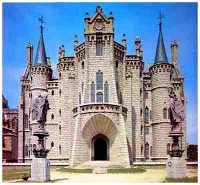
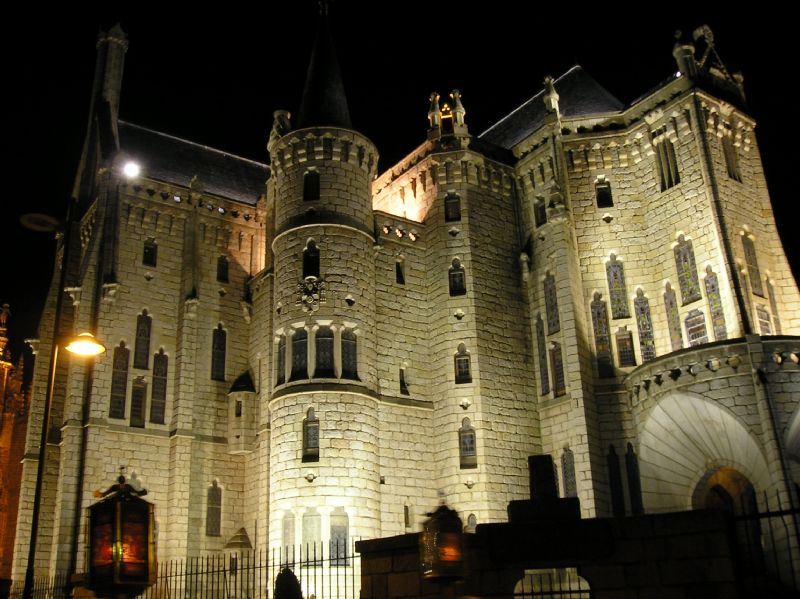
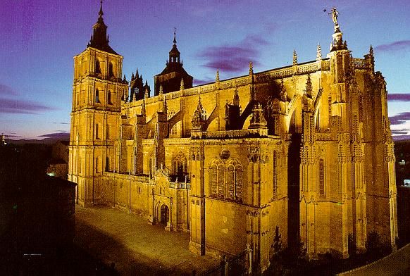
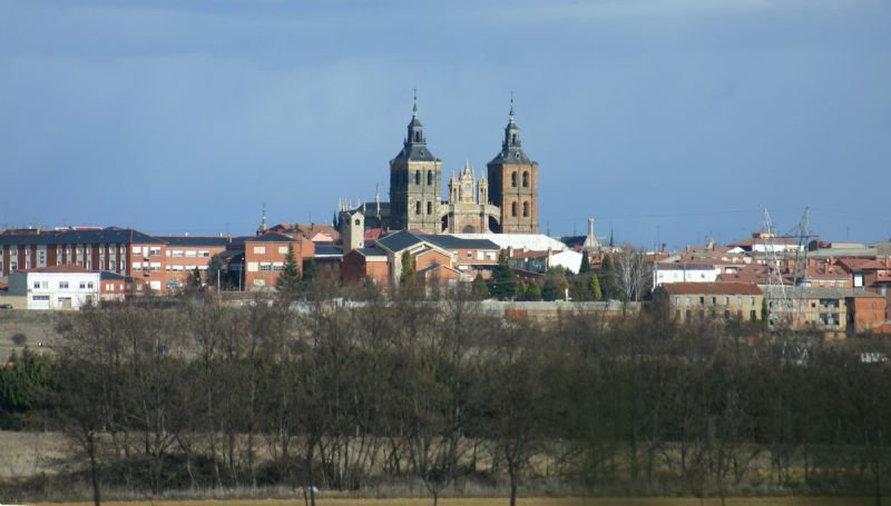
End of the Stage: Towards Astorga
From San Justo de la Vega, we continue along Calle de los Vientos and ascend to the N-120, crossing the Tuerto River Bridge. Shortly after, we leave the road and take a parallel path that leads us, after 3 kilometres, to a Roman bridge that takes us into Astorga. After crossing the railway line, we enter the city via Calle Puertasol.
Stages
- CF01 - Saint Jean de Pied de Port - Roncesvalles - 21 km
- CF02 - Roncesvalles - Zubiri - 22 km
- CF03 - Zubiri - Pamplona - 20 km
- CF04 - Pamplona - Puente la Reina - 19 km
- CF05 - Puente la Reina - Estella - 19,7 km
- CF06 - Estella - Los Arcos - 20,6 km
- CF07 - Los Arcos - Viana - 18 km
- CF08 - Viana - Navarrete - 22,3 km
- CF09 - Navarrete - Nájera - 16,9 km
- CF10 - Nájera - Santo Domingo de la Calzada - 21 km
- CF11 - Santo Domingo de la Calzada - Belorado - 22,7 km
- CF12 - Belorado - San Juan de Ortega - 24 km
- CF13 - San Juan de Ortega - Burgos - 27,6 km
- CF14 - Burgos - Hornillos del Camino - 18,3 km
- CF15 - Hornillos del Camino - Castrojeriz - 20,40 km
- CF16 - Castrojeriz - Frómista - 24,90 km
- CF17 - Frómista - Carrión de los Condes - 19,2 km
- CF18 - Carrión de los Condes - Lédigos - 23,40 km
- CF19 - Lédigos - Sahagún - 17,10 km
- CF20 - Sahagún - El Burgo Ranero - 17,9 km
- CF21 - El Burgo Ranero - Mansilla de las Mulas - 18,7 km
- CF22 - Mansilla de las Mulas - León - 18,4 km
- CF23 - León - Villadangos del Páramo - 21,8 km
- CF24 - Villadangos del Páramo - Astorga - 26 km
- CF25 - Astorga - Rabanal del Camino - 20,6 km
- CF26 - Rabanal del Camino - Molinaseca - 24,7 km
- CF27 - Molinaseca - Villafranca del Bierzo - 30,5 km
- CF28 - Villafranca del Bierzo - O Cebreiro - 30 km
- CF29 - O Cebreiro - Triacastela - 22,9 km
- CF30 - Triacastela - Sarria - 22 km
- CF31 - Sarria - Portomarín - 22 km
- CF32 - Portomarín - Palas del Rei - 23,9 km
- CF33 - Palas del Rei - Arzúa - 28,6 km
- CF34 - Arzúa - Santiago de Compostela - 38,4 km
- CF35 - O Pedrouzo - Santiago de Compostela - 20 km