
CF20 - Sahagún - El Burgo Ranero - 17,9 km
Distance18 Km.Related packages


Stage of the Camino de Santiago: From Sahagún to El Burgo Ranero
Start of the Stage: Leaving Sahagún
The stage begins in Sahagún, a key point on the Camino de Santiago. From here, pilgrims cross the Puente de Canto over the Cea River, a river that marks the natural division of Tierra de Campos. Leaving the city, the route continues, passing on the right the poplar grove of Prado de las Lanzas de Carlomagno, known for its natural beauty. After crossing a tunnel beneath the N-120, pilgrims continue towards Calzada del Coto, their next destination.
Route from Calzada del Coto to El Burgo Ranero
Upon reaching Calzada del Coto, pilgrims have two options for continuing the route:
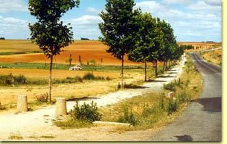
Option A: The Avenue of the Planes
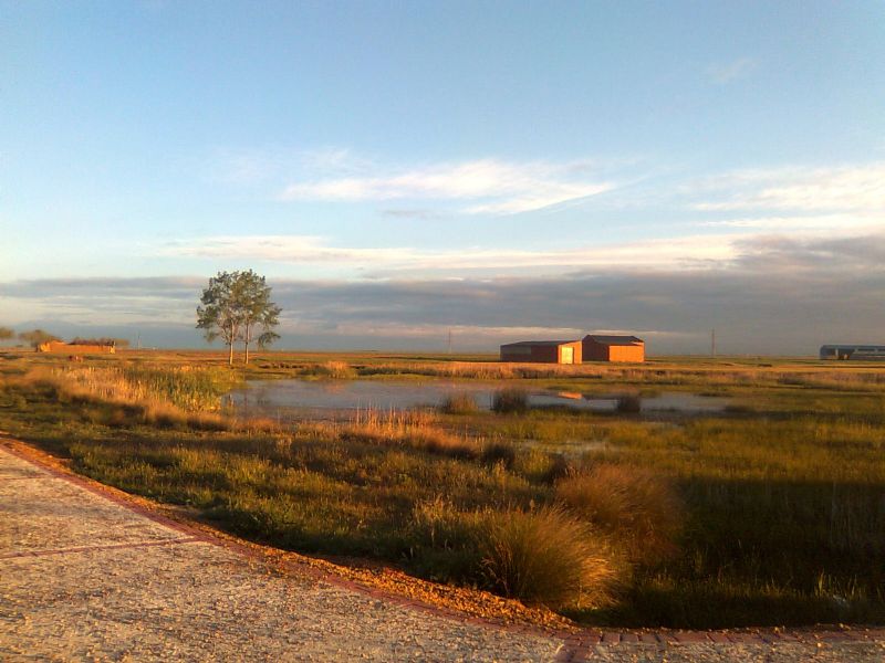
This alternative takes pilgrims along a dirt track flanked by plane trees, extending for 32 kilometres. The path is exclusive for pilgrims, with resting areas and benches along the way, allowing for a peaceful and comfortable walk. This route passes through small villages like Bercianos del Real Camino, and ends in El Burgo Ranero, after crossing the valley of the Arroyo del Olmo and a series of resting areas.
Option B: The Pilgrims' Avenue
The second option follows the Pilgrims' Avenue, built on the ancient Via Trajana. On this route, the pilgrim crosses the Palencia-La Coruña railway and enters the Dehesa de Valdelocajos, a beautiful natural area. After traversing the dehesa, pilgrims reach Calzadilla de los Hermanillos, the only village in this variant before reaching El Burgo Ranero.
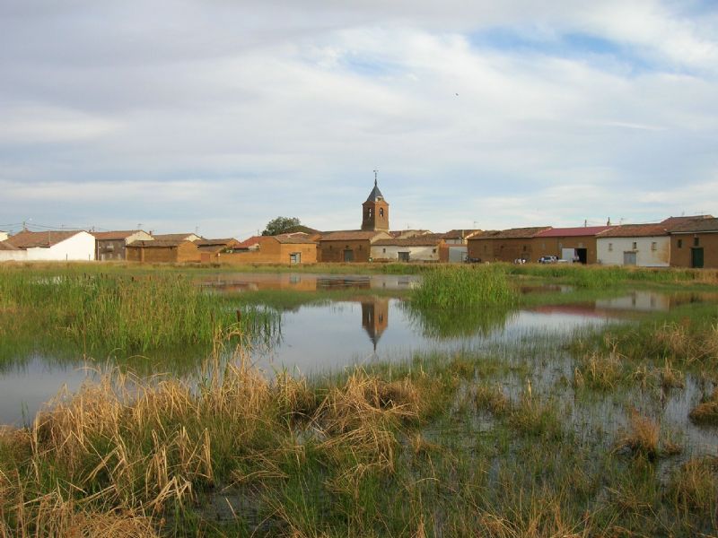
Arrival in El Burgo Ranero
Both options converge in El Burgo Ranero, a peaceful village that marks the end of this stage of the Camino de Santiago. Here, pilgrims can enjoy a well-deserved rest before continuing their journey to the next stage.
Summary of the Stage from Sahagún to El Burgo Ranero
The stage from Sahagún to El Burgo Ranero is a pleasant route offering two path options, both passing through beautiful landscapes of Tierra de Campos. Pilgrims can choose between a quieter, tree-lined path or a more historical route, following the ancient Roman roads. In either case, this stage is ideal for those looking for a relaxed walking day full of history.
Stages
- CF01 - Saint Jean de Pied de Port - Roncesvalles - 21 km
- CF02 - Roncesvalles - Zubiri - 22 km
- CF03 - Zubiri - Pamplona - 20 km
- CF04 - Pamplona - Puente la Reina - 19 km
- CF05 - Puente la Reina - Estella - 19,7 km
- CF06 - Estella - Los Arcos - 20,6 km
- CF07 - Los Arcos - Viana - 18 km
- CF08 - Viana - Navarrete - 22,3 km
- CF09 - Navarrete - Nájera - 16,9 km
- CF10 - Nájera - Santo Domingo de la Calzada - 21 km
- CF11 - Santo Domingo de la Calzada - Belorado - 22,7 km
- CF12 - Belorado - San Juan de Ortega - 24 km
- CF13 - San Juan de Ortega - Burgos - 27,6 km
- CF14 - Burgos - Hornillos del Camino - 18,3 km
- CF15 - Hornillos del Camino - Castrojeriz - 20,40 km
- CF16 - Castrojeriz - Frómista - 24,90 km
- CF17 - Frómista - Carrión de los Condes - 19,2 km
- CF18 - Carrión de los Condes - Lédigos - 23,40 km
- CF19 - Lédigos - Sahagún - 17,10 km
- CF20 - Sahagún - El Burgo Ranero - 17,9 km
- CF21 - El Burgo Ranero - Mansilla de las Mulas - 18,7 km
- CF22 - Mansilla de las Mulas - León - 18,4 km
- CF23 - León - Villadangos del Páramo - 21,8 km
- CF24 - Villadangos del Páramo - Astorga - 26 km
- CF25 - Astorga - Rabanal del Camino - 20,6 km
- CF26 - Rabanal del Camino - Molinaseca - 24,7 km
- CF27 - Molinaseca - Villafranca del Bierzo - 30,5 km
- CF28 - Villafranca del Bierzo - O Cebreiro - 30 km
- CF29 - O Cebreiro - Triacastela - 22,9 km
- CF30 - Triacastela - Sarria - 22 km
- CF31 - Sarria - Portomarín - 22 km
- CF32 - Portomarín - Palas del Rei - 23,9 km
- CF33 - Palas del Rei - Arzúa - 28,6 km
- CF34 - Arzúa - Santiago de Compostela - 38,4 km
- CF35 - O Pedrouzo - Santiago de Compostela - 20 km